blah blah blah
Mt. Agassiz
Length: 1.6 miles out-and-backDifficulty (click for info): Easy
Elevation Gain: 580 feet
Rating (click for info): 6/10
Elevation: 2378'
Prominence: 341'
Driving Directions:
Trailhead is on Rt. 142 in Bethlehem, NH, 1.1 miles south of Rt. 302 in Bethlehem and 4.1 miles northeast of exit 37 on Rt. 93. Park on the roadside, just north of the height-of-land and just south of Mountain View Lane. Click here for a Google map.
About the Hike:
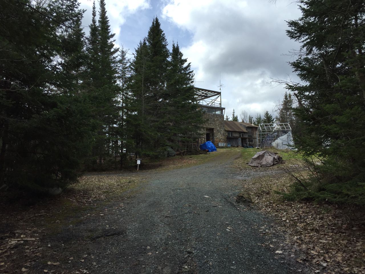
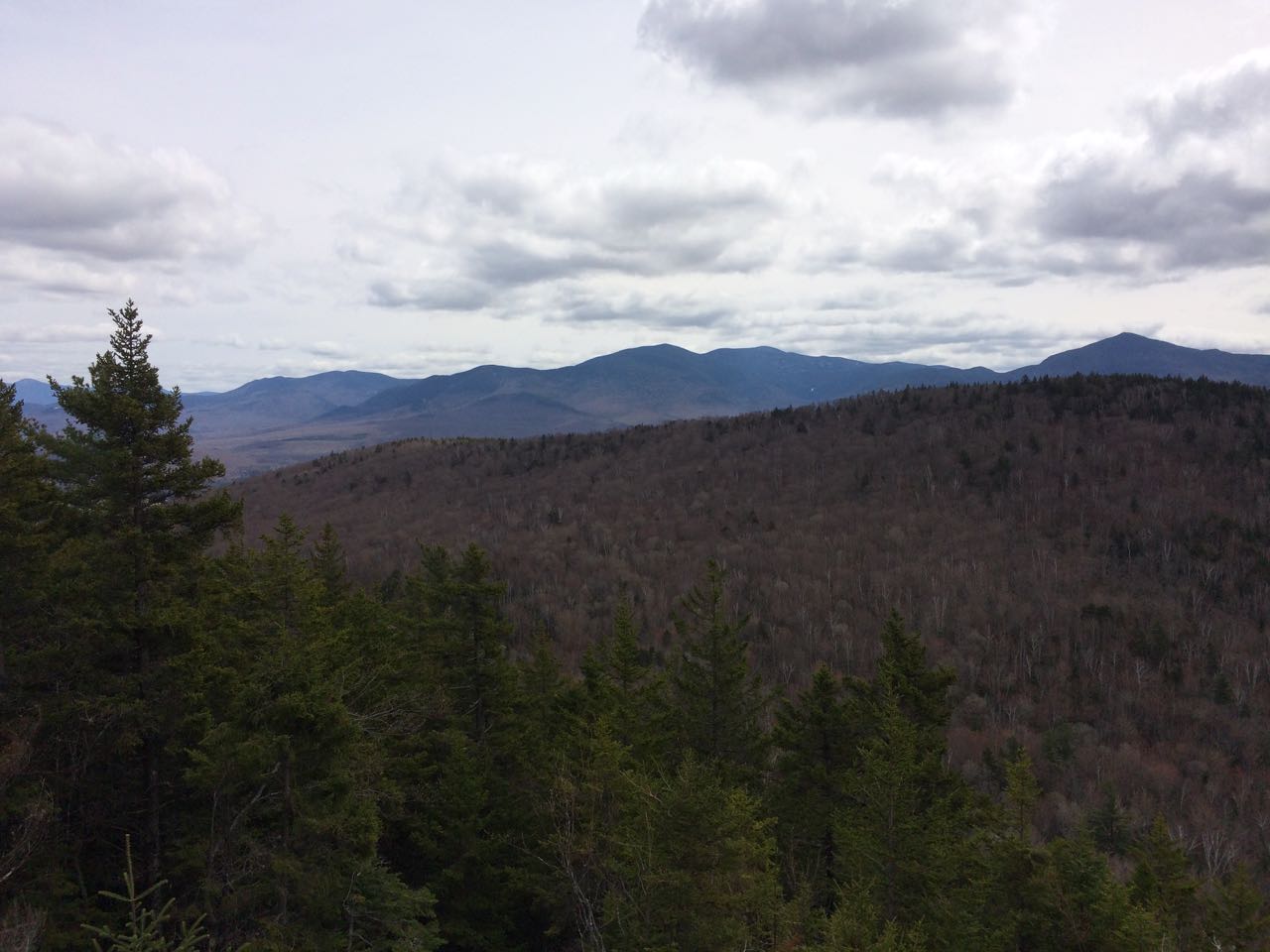
Mt. Agassiz and its higher neighbor Mt. Cleveland rise to the south of downtown Bethlehem. They are both fairly unknown to White Mountains hikers, other than by the Mt. Cleveland scenic area on Rt. 3, from which Cleveland can be seen. The summit of Mt. Agassiz is privately owned and is the location of an observatory built around the site of an old fire tower. Despite the lack of familiarity with the mountain and the unclear access (the route is briefly mentioned in the AMC White Mountain Guide), the mountain's owner welcomes hikers, providing a well-kept observation area at the summit. The route to the summit follows the private road for the observatory.
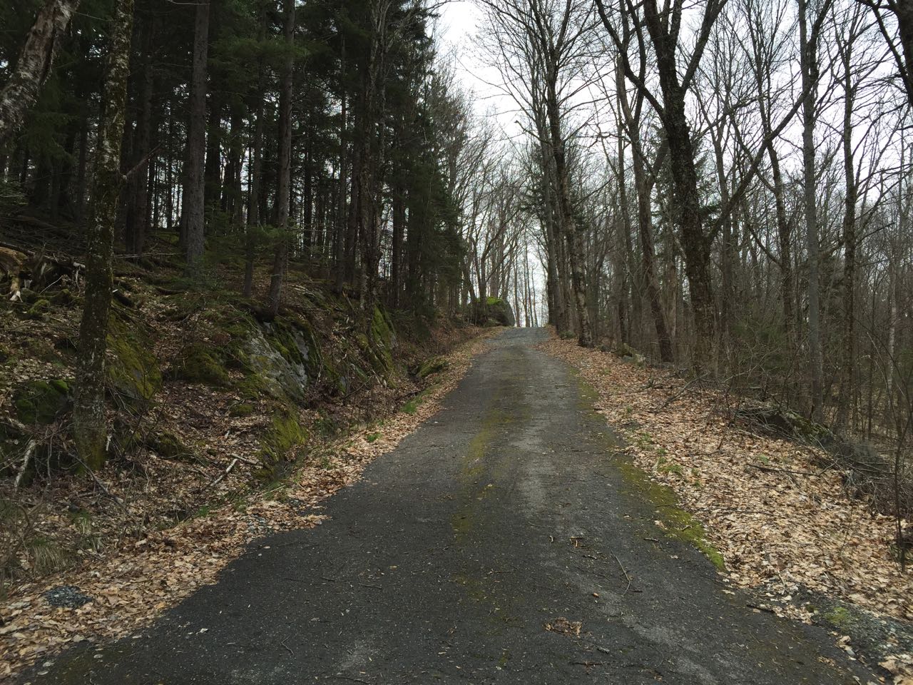
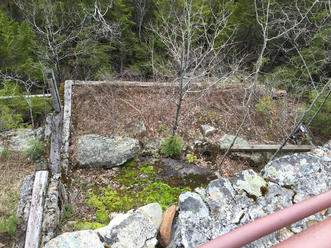
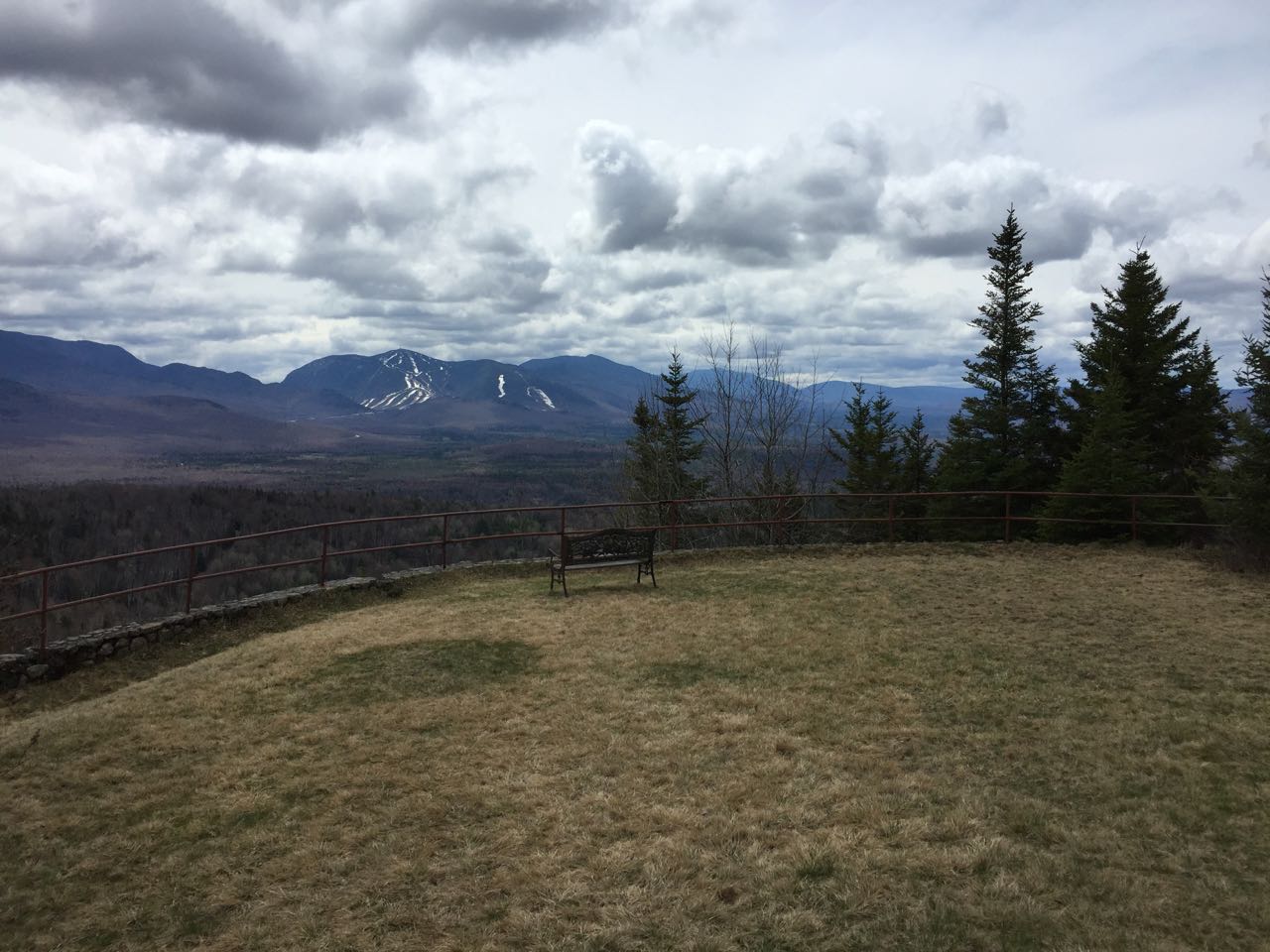
Pay close attention to the directions, because finding the private road is more difficult than you may think. From your parking spot at the height of land, walk north along the east side of the roadway. Look for what appears to be a driveway with a black mailbox, on your right. The correct driveway will be the last one before Mountain View Lane, also on the right. Walk up the driveway past a house (yes, really!) and look for a sign prohibiting "vehicular tresspassing". Below this large sign should be a small paper sign giving a description of the mountain and welcoming hikers. Continue straight, passing a few storage sheds, and walk around a gate over the road, where there is another sign welcoming hikers. From here, it is easy to follow the road for 0.8 miles to the top. The road begins to climb, and as a powerline clearing continues straight up, it swings to the right up a steep section, then swings back to the left in 0.2 miles from the main road. The road briefly turns to dirt as it crosses a small flat area, then becomes paved again as it starts to climb more steeply. It passes some nice forested ledges with a bench, then crosses the powerline cut again after 0.3 miles more. It wraps around the north side of the summit and makes a long 180-degree turn, reaching the summit in another 1/4 mile. As you approach the top, you will see the private observatory ahead. The owner requests that hikers stay away from the buildings. Bear left at an arrow marker and an informative sign detailing the history of the observatory. You will come out to a large lawn on the south side of the buildings, where there is a rounded stone embankment with a railing. If you look over the edge of the railing, you will notice a foundation from one of the original summit buildings. In the middle of the lawn is a nice bench from which hikers can enjoy the marvelous vista.
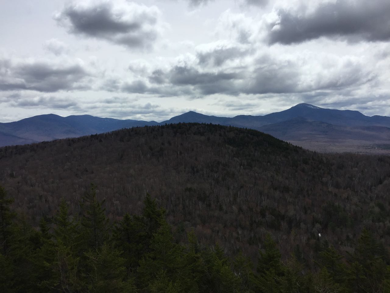
To the far left, you can glimpse the Presidential Range through the trees. Beyond the side of nearby Mt. Cleveland, you can see Mt. Hale across the Ammonoosuc River Valley, along with North and South Twin. Triangular Mt. Garfield is seen directly over the top of Cleveland. Lofty Mt. Lafayette is next over to the right, with Eagle Cliff down the ridge. Across the notch, the ski slopes of Cannon Mountain are in full view. Behind to the right, you can see Mt. Moosilauke, along with Mt. Clough and the Benton Range with Vermont in the distance furthest over to the right.
Printable directions page